Create a geographic place access point
Introduction
- The Archives Catalogue includes a taxonomy of more than 1,600 geographic place access points that support browsing, faceted browsing, and advanced searching.
- During archival processing or digitization, Archives staff convert verbatim locality information into standardized geographic place access points. Archives staff gather standardized terms from the Library of Congress Subject Headings database (LCSH).
- If LCSH does not include a standardized form of the geographic location, Archives staff construct an access point in accordance with the rules prescribed in Chapter 23 of the Rules for Archival Description.
- The Libraries also uses select places taxonomy data to:
- Maintain the /wiki/spaces/APM/pages/85688440 embedded in the Archives Catalogue.
- Help generate Darwin Core metadata for cataloguing herbarium specimens and other biodiversity material.
- Maintain the /wiki/spaces/APM/pages/85688440 embedded in the Archives Catalogue.
Create a new geographic place access point in the Archives Catalogue
Only editors and administrators of the Archives Catalogue can create new geographic place access points.
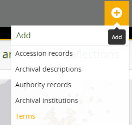
- Click on the Add menu and select "Terms":
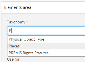
- Select Places from the drop-down list of taxonomies.
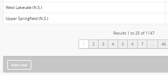
- Geographic place access points can also be created by clicking on the "Add new" button at the bottom of the "Browse Places" page.
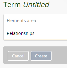
- Complete the data entry form. Refer to the following metadata guidelines.
- Click on the "Create" button to save the new access point.
Taxonomy
| Information element | Taxonomy |
|---|---|
| Darwin Core element | |
| Required | Mandatory |
| Repeatable | No |
| Guidance | Select the Places taxonomy from the auto-complete list. |
| Examples | Places |
Name
| Information element | Name |
|---|---|
| Darwin Core element | dwc.locality |
| Required | Mandatory |
| Repeatable | No |
| Guidance | Check Library of Congress Subject Headings (LCSH) for standardized form of name. Create local heading if no standardized form exists. |
| Examples |
Use for
| Information element | Use for |
|---|---|
| Darwin Core element | |
| Required | Optional |
| Repeatable | Yes |
| Guidance | Optionally, enter one or more non-preferred terms. Recommended practice is to add UF terms when they are present in the LSCH record. |
| Examples | Bombay (India) (use for Mumbai (India)) Frobisher Bay (N. T.) (use for Iqaluit (Nunavut)) |
Code
| Information element | Code |
|---|---|
| Darwin Core element | dwc.decimalLatitude dwc.decimalLongitude |
| Required | Mandatory |
| Repeatable | No |
| Guidance | Use one of the following tools to determine the decimal coordinates for the geographic place:
Tip Refer to the MaNIS georeferencing guidelines for guidance on determining decimal coordinates and interpreting vagueness in locality information. Enter the coordinates of the place in decimal degree format:
|
| Examples | 63.733333, -68.5 60, -96 |
Scope note(s)
| Information element | Scope note(s) |
|---|---|
| Darwin Core element | |
| Required | Do not use |
| Repeatable | No |
| Guidance | Do not use |
| Examples | N/A |
Source note(s)
| Information element | Source note(s) |
|---|---|
| Darwin Core element | dwc.georeferenceSources |
| Required | Mandatory |
| Repeatable | Yes |
| Guidance | Provide references to maps, gazetteers, or other resources used to georeference the locality, described specifically enough to allow anyone in the future to use the same resources. If multiple sources were used, provide references to each source. |
| Examples | National Geospatial-Intelligence Agency. "GeoNames WMS Viewer." Accessed June 18, 2018. http://geonames.nga.mil/namesviewer/default.asp. Natural Resources Canada. "Canadian Geographic Names Database." Accessed June 18, 2018. http://www4.rncan.gc.ca/search-place-names/search?lang=en. U.S. Geological Survey. "Earth Explorer." Accessed June 18, 2018. https://earthexplorer.usgs.gov/. |
Display note(s)
| Information element | Display notes(s) |
|---|---|
| Darwin Core element | |
| Required | Do not use |
| Repeatable | No |
| Guidance | Do not use |
| Examples | N/A |
Broad term
| Information element | Broad term |
|---|---|
| Darwin Core element | |
| Required | Mandatory |
| Repeatable | No |
| Guidance | Continents are the broadest terms in the taxonomy. Use counties as broader terms for municipalities located within Nova Scotia. Use provinces, territories, or states as broader terms for municipalities found elsewhere in Canada or within the United States. Use countries as broader terms for municipalities located in other countries. Enter the broader term for the geographic place, as follows:
|
| Examples |
Related term(s)
| Information element | Related term(s) |
|---|---|
| Darwin Core element | |
| Required | Do not use |
| Repeatable | No |
| Guidance | Do not use |
| Examples | N/A |
Converse term
| Information element | Converse term |
|---|---|
| Darwin Core element | |
| Required | Do not use |
| Repeatable | No |
| Guidance | Do not use |
| Examples | N/A |
Add new narrower terms
| Information element | Add new narrower terms |
|---|---|
| Darwin Core element | |
| Required | Do not use |
| Repeatable | No |
| Guidance | Do not use |
| Examples | N/A |
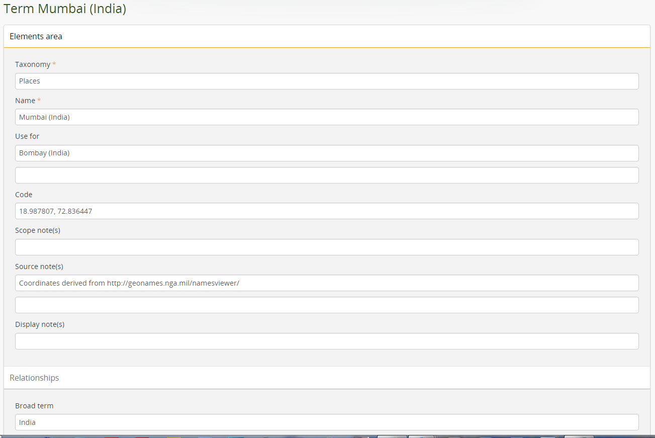
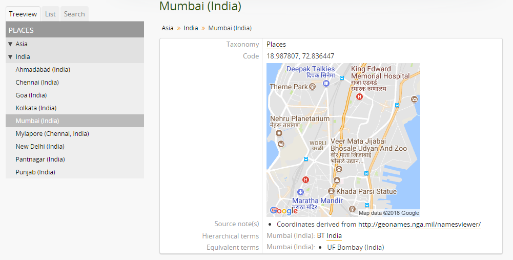
Example: Mumbai (India)
The geographic place heading for Mumbai includes all five mandatory fields and an optional "Use for" note to redirect researchers who may still use the old place name "Bombay."
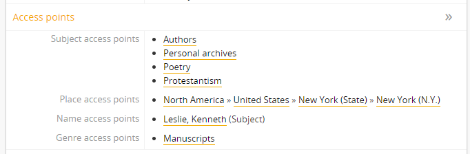
The treeview on the left and the breadcrumb links under the access point title illustrate the hierarchical organization of the Places taxonomy. The heading for Mumbai is nested under India, which is nested under Asia, a top-level term in the taxonomy.
The access point also includes a static Google map image, which AtoM generates automatically based on the coordinates in the Code field.
Add geographic place access point to an archival description
- Click on the Access points area of the archival description.
- Search for an existing term in the Places taxonomy by typing the first few characters of the term name. Do not attempt to create new terms in the archival description. If a desired term is not in the Places taxonomy, see a staff member with editor or administrator privileges.
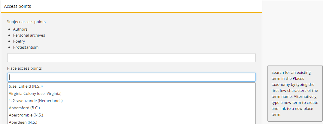
- Select the correct term(s).
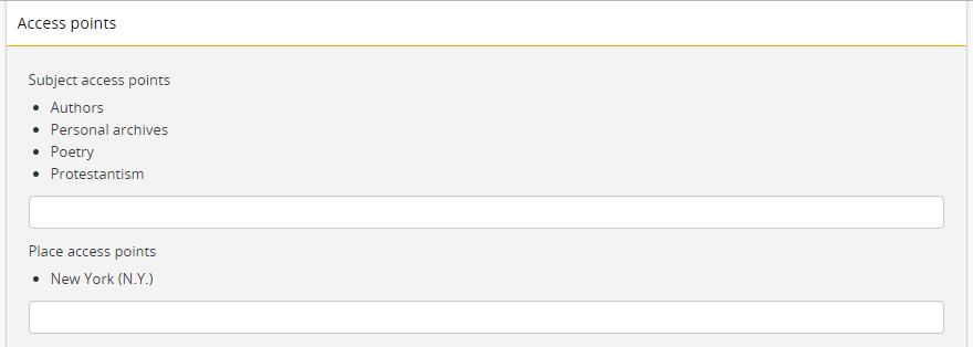
- Click on the "Save" button at the bottom of the screen.

- Review the archival description to ensure the place name is accurate and shows the desired hierarchy.
Related resources
MaNIS georeferencing guidelines: http://manisnet.org/GeorefGuide.html.